The answer is WAYMARKING.
Waymarking is a term used to describe the specific symbol which is used to mark a route people travel. Waymarks sometimes follow the route in one direction, or in other cases allow a route to be followed in both directions. Following is an explanation from the Confraternity of St. James website.
The waymarking along the Camino Santiago is,in general, very good. In France, the route from St.-Jean-Pied-de-Port is part of the long-distance GR65 footpath, and is marked by the red and white flash of the GR network. There are separate red and white to indicate changes of direction, and a red line crossed with a white one to indicate that you have taken the wrong turning.
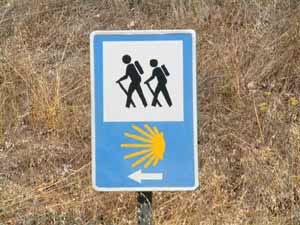
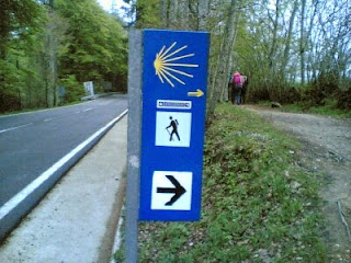
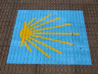
In Spain, the official mark is the stylized scallop shell on a blue background, which is often placed on the walls of houses well above eye level to indicate the route through villages and towns. In open country, one frequently encounters these signs are often found embedded in small concrete pillars. There are also signboards with this mark at the top, a pedestrian sign in the middle, and a direction arrow at the bottom; these are much used at road crossings.
The red and white GR flashes are also found from time to time in Spain. However, the most common mark is a yellow arrow, which may be painted on trees, rocks, kerbstones, storm water gutters etc. Sometimes a yellow stripe is painted on trees as a continuation marker for reassurance. Some other waymarks incorporating the scallop shell can be found.
When walking the Camino Frances or most of the other routes to Santiago, one does not need a map... you simply follow the waymarks!
Here are a variety of waymarks you might expect to see on the Camino de Santiago. Some may be duplicates as I have combined two blog posts here.
These photos have been taken from the internet and I apologize to anyone who'd like credit and didn't get it. As you can see, the way is well marked!


No comments:
Post a Comment
All comments are moderated.